Mao (Mao)
Mao (مؤ) is a city in Chad, the capital of the Kanem Region and of the department also named Kanem. It is the 16th most populous city in Chad, and is located 226 km north-northeast of N'Djamena.
On the border of the Sahara, Mao's geography is marked by sand dunes and sparse vegetation. A large majority of Mao's residents are Muslim. There are two Christian churches (one Catholic and one Protestant) in Mao.
As in other Chadian regions, Mao is ruled by both a traditional Sultan and by central government officials. The Sultan of Kanem, who resides in Mao, is the traditional chief of the Kanembou people. Moves toward decentralisation have been stymied by the complex and sometimes tense relationships between traditional rulers in Chad and national authorities.
Mao was created in 1898 by Sultan Ali, brother of Sultan Djourab who was assassinated by the Fezzans and other accomplices. Since 1900, Mao has been the effective administrative center of the north.
On 18 July 2010, the Sultan of Kanem, Alifa Ali Zezerti, died in hospital in N'Djamena aged 83, from complications from a heart attack. He was the 39th ruler of the Kanem dynasty, and had reigned since 1947. He was buried in Mao. His predecessor, Sultan Zezerti, had died on 26 September 1947, having ruled since 1925. His son was elected as Sultan in a by-election without competition.
In October 2013, riots broke out in Mao's main market directed against the administration of Idriss Déby after the shooting dead of a civilian by an officer close to Déby.
On 30 September 2015, around 8 pm, a major fire burned through the main market of Mao. The origin could not be determined. No deaths were reported.
On 12 May 2016, at 5 am, a large fire spread throughout the main market of Mao, the second in under two years. The fire started in a nearby fuel depot. No human casualties were reported.
Map - Mao (Mao)
Map
Country - Chad
 |
 |
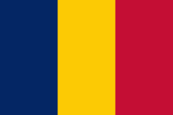
| Flag of Chad | |
Chad has several regions: a desert zone in the north, an arid Sahelian belt in the centre and a more fertile Sudanian Savanna zone in the south. Lake Chad, after which the country is named, is the second-largest wetland in Africa. Chad's official languages are Arabic and French. It is home to over 200 different ethnic and linguistic groups. Islam (55.1%) and Christianity (41.1%) are the main religions practiced in Chad.
Currency / Language
| ISO | Currency | Symbol | Significant figures |
|---|---|---|---|
| XAF | Central African CFA franc | Fr | 0 |
| ISO | Language |
|---|---|
| AR | Arabic language |
| FR | French language |


